Here’s a little showcase on how this package can be used. Just some code, with not much explaination.
Get Data
Initialize the file directory and load the dataset sample_polygons containing the largest 10 municipalities in Switzerland.
Prepare Vector Data
Calculate area and population density per municipality:
sample_polygons <- sample_polygons %>%
  mutate(
    area_km2 = as.integer(st_area(sample_polygons)/1000000),
    dichte = EINWOHNERZ/area_km2
    )
Create an cookiecutter shape for each feature.
exts <- sample_polygons %>%
  get_extent(.,x_add = 0,y_add = 0,method = "bbox",per_feature = T,asp = 1)

exts_large <- sample_polygons %>%
  get_extent(.,x_add = 1000,y_add = 1000,method = "bbox",per_feature = T,asp = 1)

ext_inv <- exts %>%
  st_geometry() %>%
  map2(st_geometry(sample_polygons),~st_difference(.x,.y)) %>%
  st_sfc() %>%
  st_set_crs(2056)
Prepare Figure Captions
Create a (text) caption per municipality which can later be included as a caption.
caption <- st_set_geometry(sample_polygons,NULL) %>%
pmap_chr(function(NAME,EINWOHNERZ,area_km2,dichte,rank){
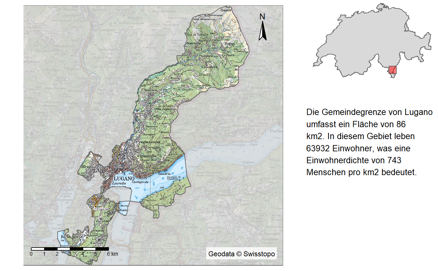
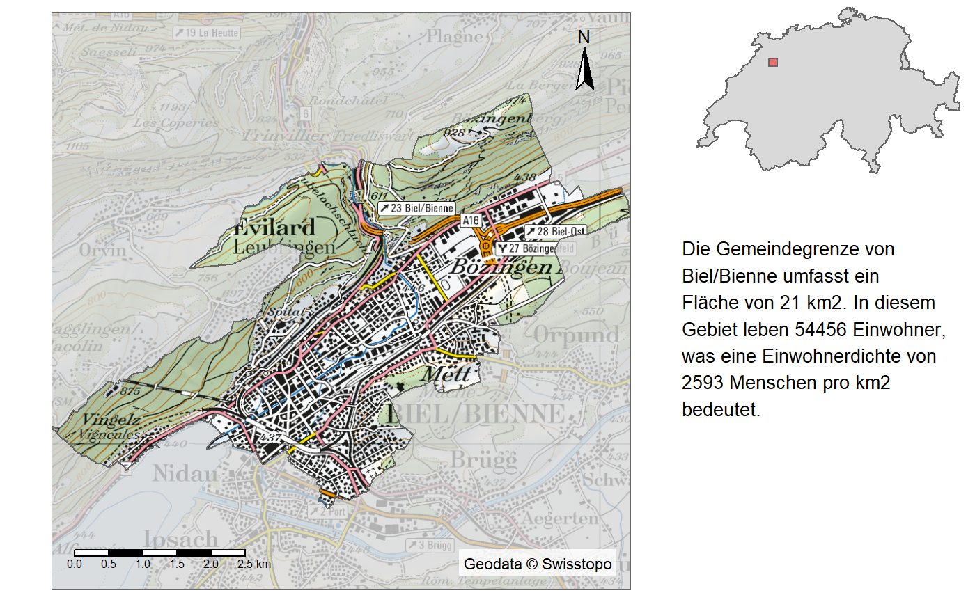
glue("Die Gemeindegrenze von {NAME} umfasst ein Fläche von {area_km2} km2. In diesem Gebiet leben {formatC(EINWOHNERZ,big.mark = ",")} Einwohner, was eine Einwohnerdichte von {as.integer(dichte)}
Menschen pro km2 bedeutet.")
})Create plots
Run a loop over each feature calling get_raster() within the plot. This avoids saving all the rasters in a huge list.
data("switzerland")

for(i in 1:nrow(sample_polygons)){
  extent_indicator <- tm_shape(switzerland) +
    tm_polygons() +
    tm_shape(exts_large[i,]) +
    tm_polygons(col = "red", alpha = 0.5) +
    tm_layout(frame = F) +
    tm_view(alpha = 0)
  mainmap <- tm_shape(get_raster(exts[i,],100)) +
    tm_rgb() +
    tm_shape(ext_inv[i])+
    tm_polygons(alpha = 0.8,fill = "white") +
    tm_scale_bar(position = c("left","bottom")) +
    tm_credits(credits("swisstopo"),bg.color = "white",bg.alpha = 0.8) +
    tm_compass(position = c("right","top")) +
    tm_layout(frame = F)
  grid.newpage()
  print(mainmap, vp=viewport(0,0,0.7,1,just = c("left","bottom")))
  print(extent_indicator, vp=viewport(1,1,0.3,0.3,just = c("right","top")))
  grid.text(sapply(strwrap(caption[i],30,simplify = F), paste, collapse = "\n"),
            x = 0.7,
            y = 0.6,
            vjust = 1,
            hjust=0,
            gp=gpar(fontsize=10))
}
## Collective Size of Rasters to harmonize: 138.24516 (mb)## Collective Size of Rasters to harmonize: 64.0809 (mb)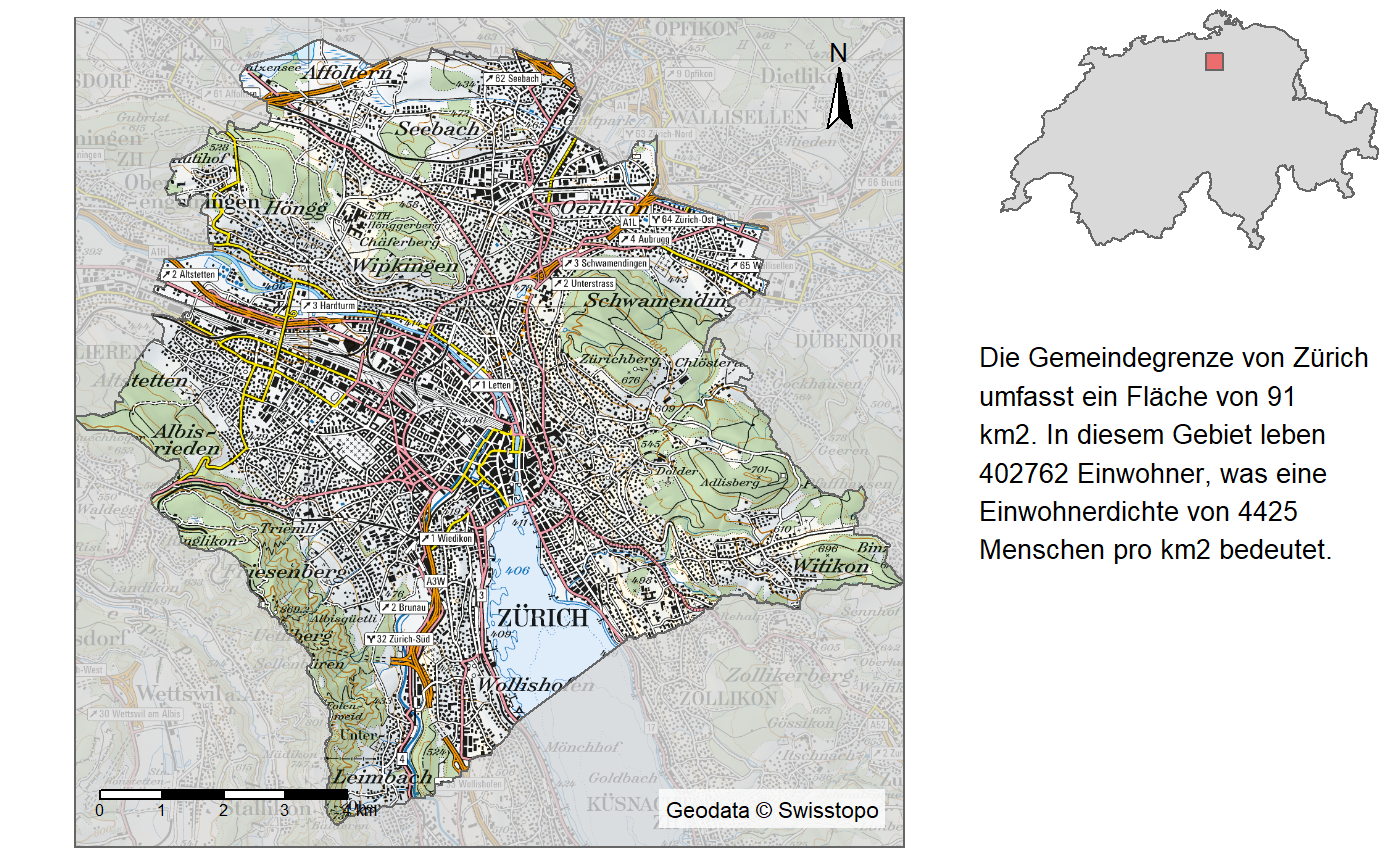
## Collective Size of Rasters to harmonize: 61.425089 (mb)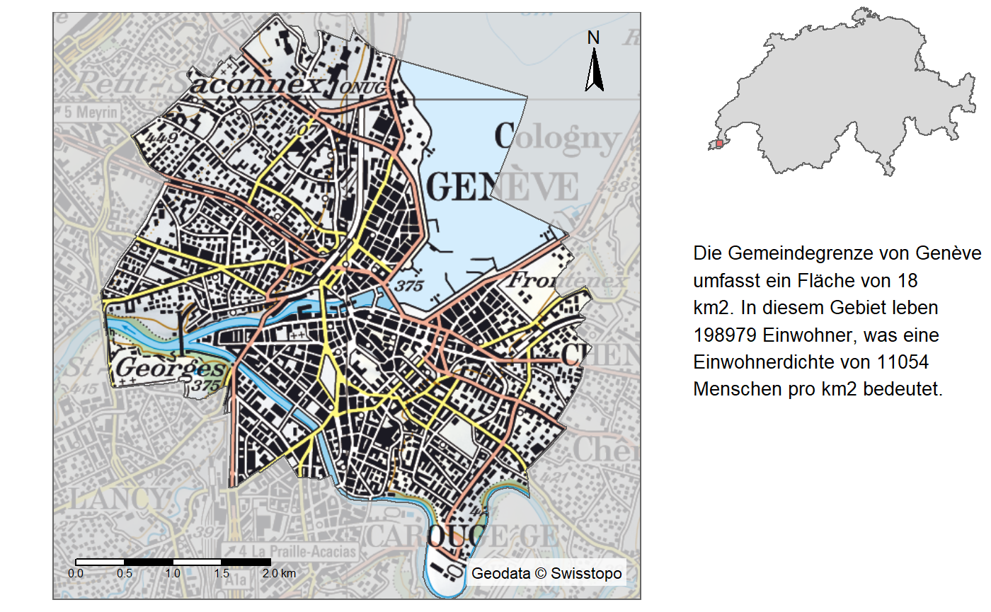
## Collective Size of Rasters to harmonize: 130.175831 (mb)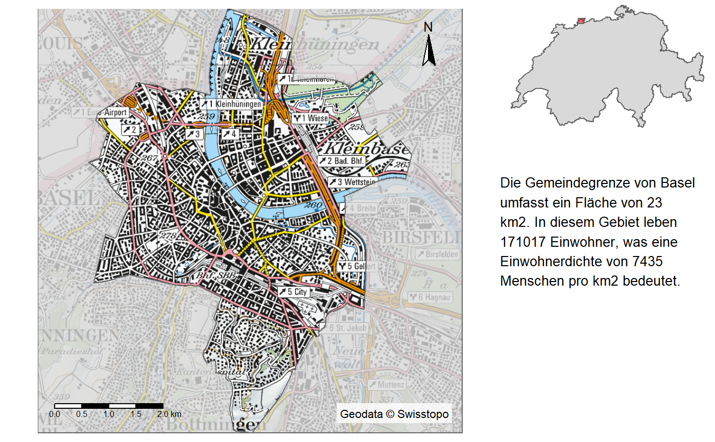
## Collective Size of Rasters to harmonize: 137.074061 (mb)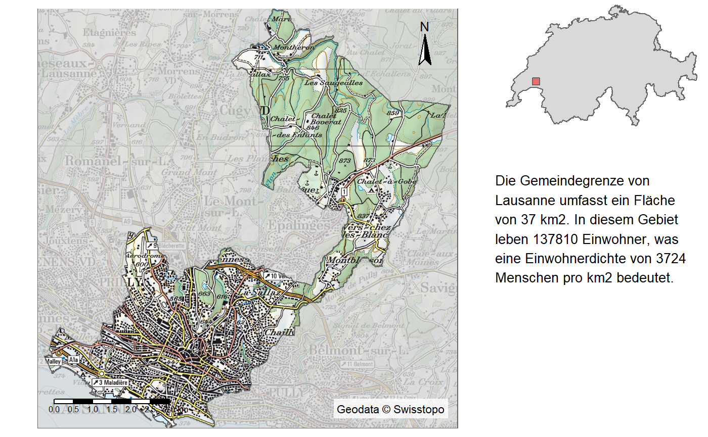
## Collective Size of Rasters to harmonize: 61.408868 (mb)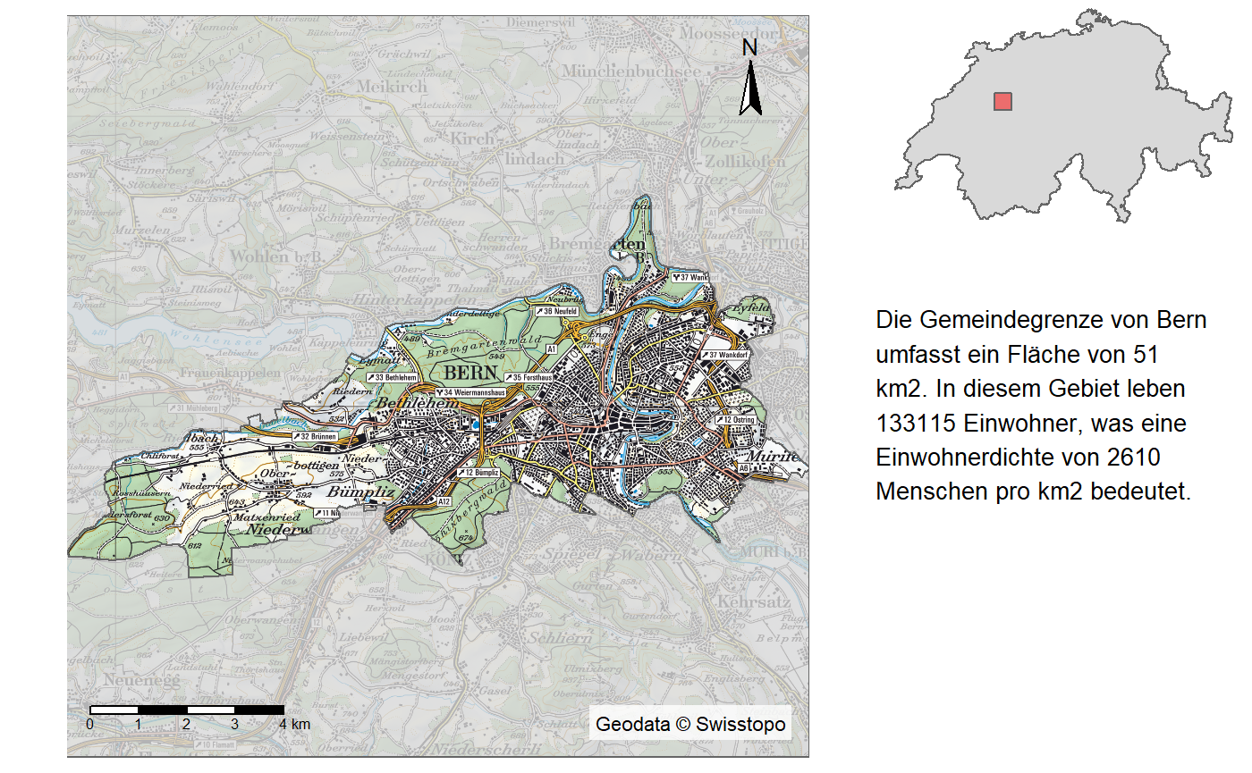
## Collective Size of Rasters to harmonize: 67.787406 (mb)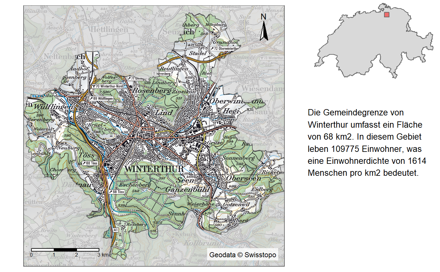
## Collective Size of Rasters to harmonize: 132.685739 (mb)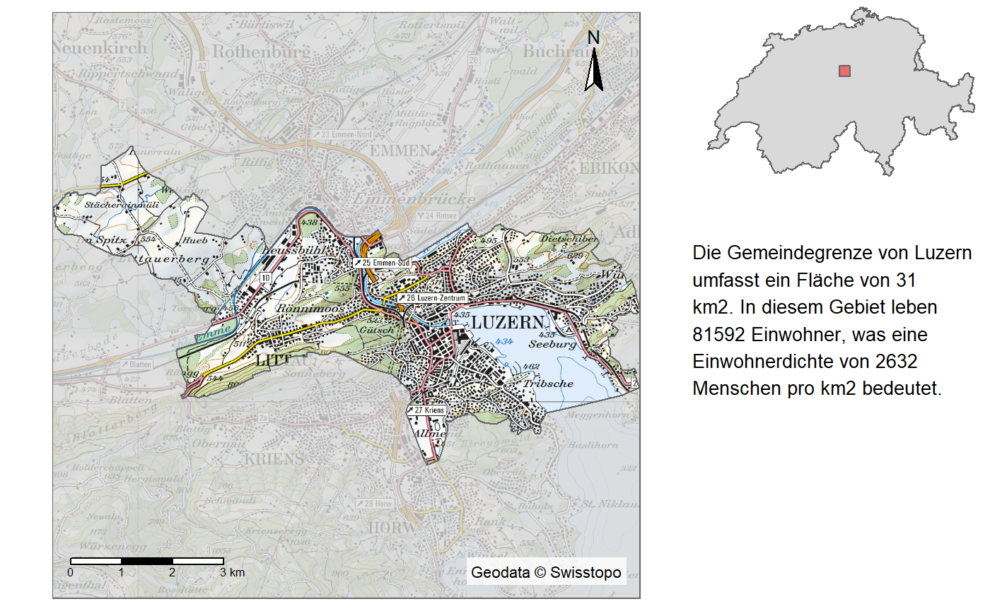
## Collective Size of Rasters to harmonize: 71.149182 (mb)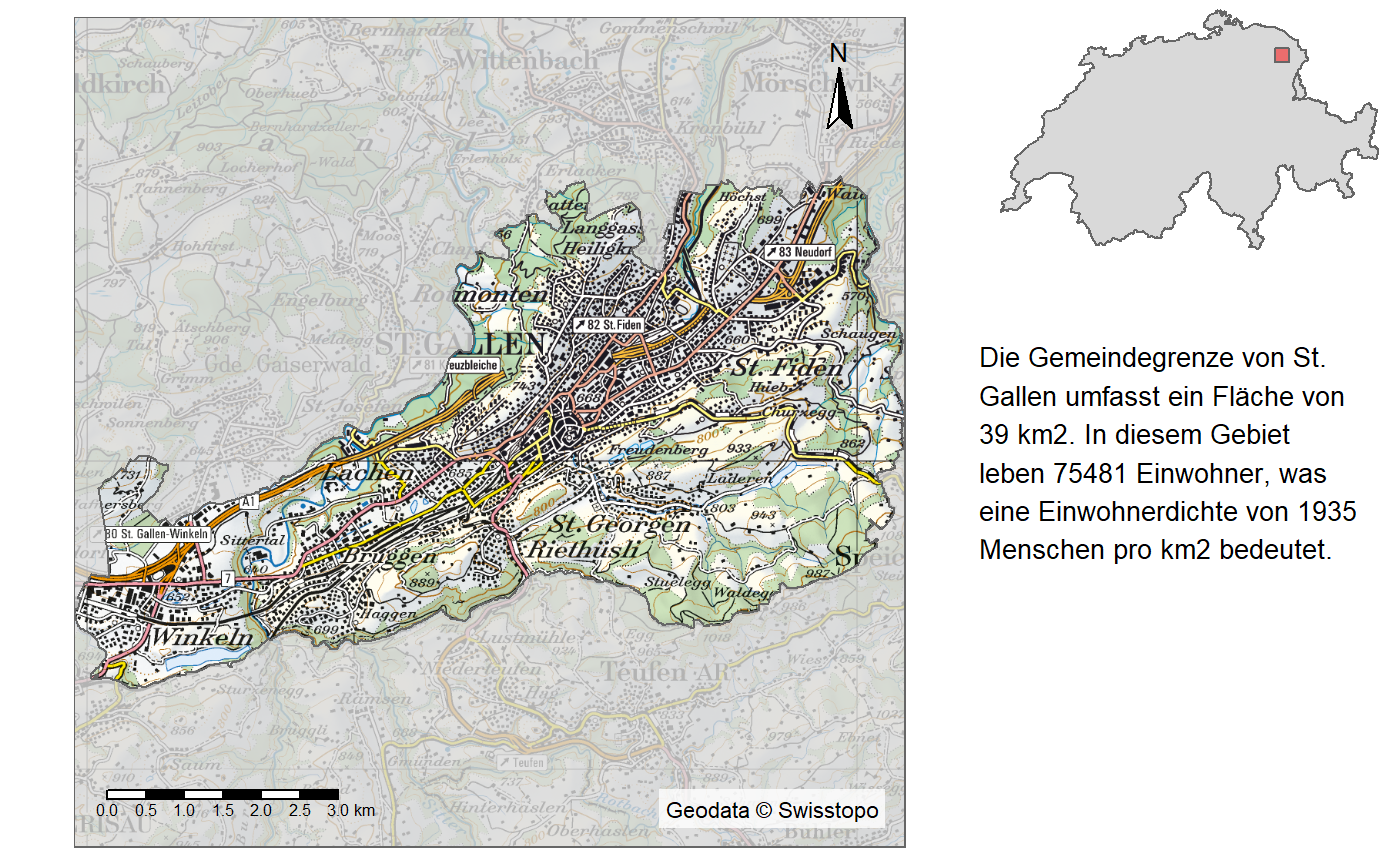
## Collective Size of Rasters to harmonize: 67.559457 (mb)